In the last quarter of 2023, office space vacancy rate in San Francisco stood at 32%, marking a 2% point increase from the previous quarter (1). This trend suggests a lasting change in the office market and underlines how the shift in workplace habits might be here to stay. By comparison, European urban centers have demonstrated a stronger resilience in bouncing back from the pandemic (2). Despite the looming shadows of war, cities in Europe seem to have rekindled the vibrancy and dynamism typical of their urban environments. Why is that the case? Besides structural and economic differences with the US, a personal connection to places may have played a role in Europe’s urban recovery.

Figure 1. San Francisco office space rate by quarter // SOURCE: San Francisco Economic Recovery Dashboards - Figure 2. Office Vacancy Rate (%), Q4 2005 - Q4 2023 // SOURCE: JLL
Hayes Valley provides an insight into how a distinct sense of place can drive urban vitality in San Francisco. With its local boutiques, cafes, public art, and open space, Hayes Valley has emerged as one of the city’s epicenters of innovation (3), with one of the highest concentrations of AI startups in the city. According to a recent Bloomberg report the reason for Hayes Valley’s dynamism can be attributed to its ‘soul’. And this is what ultimately should be the goal for downtown, to find its soul.
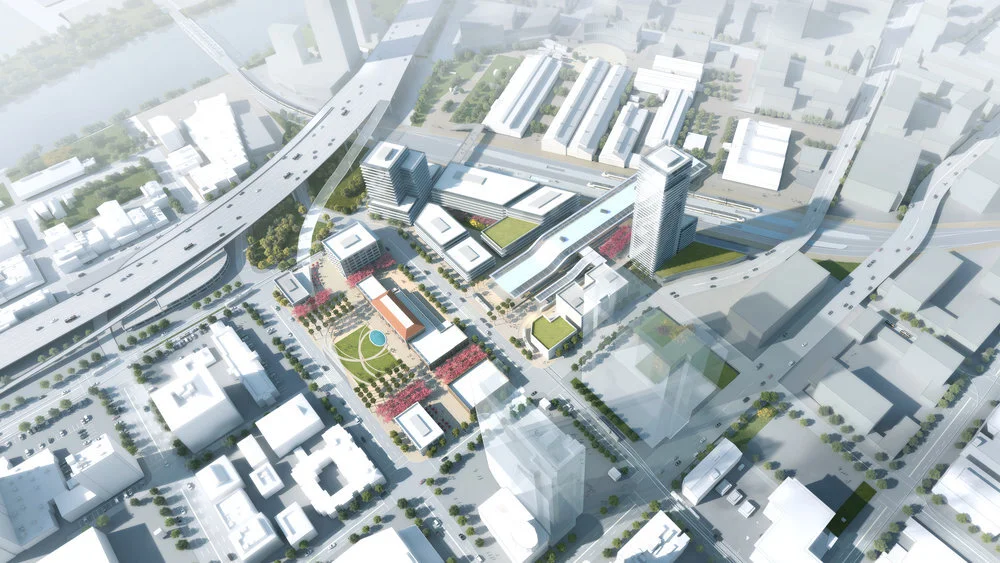
Embracing the need to infuse downtown with a unique spirit, the passage of Proposition C promises to breathe new life into downtown. The provision for a one-time transfer tax waiver is designed to nudge investors into repurposing underperforming office spaces, potentially untapping approximately 4,200 housing units (4). This and other initiatives align with the city’s ‘Roadmap to San Francisco’s Future’, a nine-point strategy that aims to transform the city’s business core into a more vibrant and resilient mixed-use district, fostering a distinct sense of community and supporting innovation, creativity, and economic growth.

Left: 'Holy Stitch!' on California and Davis Street (part of 'Vacant to Vibrant' initiative). - Right: 'Park Padel' at Justin Herman Plaza.
The quality of public open spaces is key to realizing this vision. Welcoming, comfortable, and engaging public open spaces are a platform for social interaction, and are crucial to elevating the downtown experience for daily commuters, residents, and visitors alike. From work to leisure, the pandemic has starkly highlighted our desire for a deeper connection to nature and the outdoors in all aspects of our lives. Integrating more nature into downtown not only enhances its aesthetic appeal but also supports its community's mental and physical well-being while contributing to the city’s resilience objectives. The recently released Draft Plan for a more resilient San Francisco Waterfront (5) represents a significant leap forward in this direction. The $13 billion, 7.5 miles plan sets a model for how cities can adapt to climate change while enhancing urban vitality. While addressing the urgent need for effective measures against sea level rise, the plan sets the stage for a more vibrant and accessible waterfront, providing downtown with opportunities for a stronger connection to the waterfront, new public spaces, and improved access to nature.

Tentatively Selected Plan's Initial Actions of the // SOURCE: U.S. Army Corps of Engineers
As we reflect on the unique qualities of San Francisco, its natural environment should inform the vision for its downtown, a place that embodies the remarkable natural beauty of the region, enriching the life of its community. The connection to nature is deeply woven into the very lifestyle and ethos of San Franciscans, who have an intimate relationship with the ocean, the natural landscape, and the rolling fog. This profound bond with nature transcends simple enjoyment, it informs the character of the city and the spirit of its diverse community. As we stand on the brink of a new era, marked by tremendous technological leaps and changing urban dynamics, let's have the efforts to rejuvenate downtown be guided by the quest for its soul. A downtown that embodies the spirit of San Francisco's diverse community, the tireless forward-looking spirit of its people, and a deep, soulful connection with its natural environment.
(1) San Francisco office space rate by quarter (February 2024). San Francisco Economic Recovery Dashboards. Retrieved from https://www.sf.gov/data/san-francisco-office-space-vacancy
(2) Signs of gradual recovery in demand. Global Real Estate Perspective February 2024. JJL. Retrieved from https://www.us.jll.com/en/trends-and-insights/research/global/gmp/office
(3) AI map: Where the young and restless driving the AI boom hang out (October 2023). Mission Local. Retrieved from https://missionlocal.org/2023/10/ai-map/
(4) From Workspace to Homebase (October 2023). SPUR. Retrieved from https://www.spur.org/sites/default/files/2023-10/SPUR_From_Workspace_to_Homebase.pdf
(5) San Francisco Waterfront Coastal Flood Study, CA. Draft Integrated Feasibility Report and Environmental Impact Statement (January 2024). U.S. Army Corps of Engineers (USACE). Retrieved from https://www.swt.usace.army.mil/Portals/41/SFWCFS_DIFR_EIS_Main%20Report_1.pdf